
Kod: 06815949
Spatial Modeling of Soil Salinity Using Remote Sensing, GIS, and Field Data
Autor Eldeiry Ahmed
The environmental damage that salinity can cause is massive. In its early stages, soil salinization reduces soil productivity, but in advanced stages, salinization kills all vegetation and transforms fertile and productive land to ... więcej
- Język:
 Angielski
 - Oprawa: Miękka
- Liczba stron: 112
Wydawca: VDM Verlag Dr. Mueller E.K., 2008
- Więcej informacji o książce

Zobacz książki o podobnej tematyce
Podaruj tę książkę jeszcze dziś
- Zamów książkę i wybierz "Wyślij jako prezent".
- Natychmiast wyślemy Ci bon podarunkowy, który możesz przekazać adresatowi prezentu.
- Książka zostanie wysłana do adresata, a Ty o nic nie musisz się martwić.
Więcej informacji o Spatial Modeling of Soil Salinity Using Remote Sensing, GIS, and Field Data
Za ten zakup dostaniesz 137 punkty
 Opis
Opis
The environmental damage that salinity can cause is massive. In its early stages, soil salinization reduces soil productivity, but in advanced stages, salinization kills all vegetation and transforms fertile and productive land to barren waste. Remote sensing data has great potential for monitoring dynamic processes, including salinization. Any integration of field data, GIS, and remote sensing is considered weak unless some strong statistical measures are introduced. This study has shown the benefit of using satellite images in generating accurate soil salinity maps. Corn and alfalfa crops were selected as indicators of soil salinity. Five images were acquired from Aster, Ikonos, and Landsat to check the correlation between measured soil salinity and remote sensing data. Observed data was used in conjunction with satellite images. Three models were applied to predict soil salinity from remote sensing: the ordinary least squares model (OLS), spatial autoregressive model (SAR), and modified kriging model. This study has demonstrated a more efficient and accurate way of estimating soil salinity from remote sensing data that should help the efforts toward sustainable agriculture.
 Szczegóły książki
Kategoria Książki po angielsku Earth sciences, geography, environment, planning Geography
54.88 €
- Pełny tytuł: Spatial Modeling of Soil Salinity Using Remote Sensing, GIS, and Field Data
- Autor: Eldeiry Ahmed
- Język:
 Angielski
 - Oprawa: Miękka
- Liczba stron: 112
- EAN: 9783639065978
- ISBN: 3639065972
- ID: 06815949
- Wydawca: VDM Verlag Dr. Mueller E.K.
- Waga: 159 g
- Wymiary: 229 × 152 × 6 mm
- Data wydania: 04. August 2008
Ulubione w innej kategorii
-
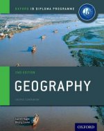
Oxford IB Diploma Programme: Geography Course Companion
71.35 € -

Cambridge International AS and A Level Geography Skills Workbook
23.24 € -

Geography: An Integrated Approach
98.95 € -

DANUBE BIKE TRAIL 1 DONAUESCHINGEN TO PA
14.65 € -9 % -

Cambridge International AS and A Level Geography second edition
84.90 € -

Human Geography
49.92 € -

Birds of New Guinea
48.51 € -9 % -

IB Geography Study Guide: Oxford IB Diploma Programme
47.70 € -
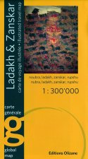
LADAKH ZANSKAR OLIZANE RV WP
31.53 € -

West Midlands A-Z Street Atlas (spiral)
23.44 € -4 % -
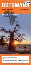
BOTSWANA TRACKS R V R WP
22.53 € -9 % -

ALBANIA RKH RV R WP GPS
11.21 € -9 % -

Garibaldi
66.60 € -

Future of Packaging
24.45 € -21 % -

IB Geography Course Book: Oxford IB Diploma Programme
46.08 € -

Cambridge International AS & A Level Geography Student's Book
50.53 € -

Justinianic Mosaics of Hagia Sophia and Their Aftermath
107.13 € -

comfort! map USA
13.53 € -5 % -
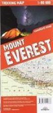
terraQuest Trekking Map Mount Everest
21.62 € -

Level Geography Fieldwork & Skills
67.11 € -

Birds of Hawaii and Micronesia
26.27 € -6 % -

Geography
67 € -

Essential Maths Skills for AS/A-level Geography
16.57 € -7 % -

Dictionary of Physical Geography, 4e
46.39 € -8 % -

Do Earth
11.92 € -16 % -

Economic Geography - A Contemporary Introduction 3e
49.72 € -1 % -

Butterflies of Europe
32.64 € -5 % -

Incredible History of India'a Geography
11.61 € -4 % -

History of the Adriatic: A Sea and Its Civilizatio n Cloth
24.55 € -31 % -

Birds of Prey of the East
22.03 € -23 % -

Porto - Michelin City Plan 85
7.87 € -10 % -

Geology of Egypt
36.98 € -

Urban Planning Imagination - A Critical International Introduction
23.64 € -7 % -
OCR A2 Geography Textbook
7.67 € -58 % -

New Literary History of Modern China
50.43 € -9 % -

Once Within Borders
30.01 € -2 % -

IB Diploma
41.33 € -

Geography for Cambridge International AS and A Level Revision Guide
37.19 € -

Birds of Prey of the West
24.05 € -17 % -

Road Map Normandy
13.13 € -4 % -

Biogeography and biomorphology
24.75 € -

Publics and the City
48.71 € -
Quantitative Geography
45.68 € -6 % -

Havana / Cuba Central
12.83 € -5 % -

Planetary Social Thought
28.29 € -

Edexcel GCE Geography Y2 A Level Student Book and eBook
48.61 € -
Saint Kitts / Nevis
19.30 € -8 % -

Walter Benjamin
29.40 € -9 % -
Historical Population Atlas of the Czech Lands
33.75 € -6 %
Osobní odběr Bratislava a 2642 dalších
Copyright ©2008-24 najlacnejsie-knihy.sk Wszelkie prawa zastrzeżonePrywatnieCookies


 Vrácení do měsíce
 Zdarma od 49.99 €
 02/210 210 99 (8-15.30h)