Kod: 01382028
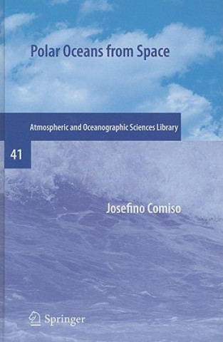
Polar Oceans from Space
Autor Josefino Comiso
The book presents a wealth of material about the polar oceans, more specifically the ice-covered areas and peripheral seas. It provides a detailed history of the changing climate of the polar oceans as observed by satellite sensor ... więcej
- Język:
 Angielski
 - Oprawa: Twarda
- Liczba stron: 507
Wydawca: Springer-Verlag New York Inc., 2010
- Więcej informacji o książce

167.75 €
Dostępność:
50 % szansa Otrzymaliśmy informację, że książka może być ponownie dostępna. Na podstawie państwa zamówienia, postaramy się książkę sprowadzić w terminie do 6 tygodni. Gwarancja pełnego zwrotu pieniędzy, jeśli książka nie zostanie zabezpieczona.
Przeszukamy cały świat
Zobacz książki o podobnej tematyce
-

National Geographic Traveler: Portugal, 4th Edition
16.64 € -21 % -

Spider's Web
22.20 € -

Promise Kept To Bear Witness
16.34 € -

Disillusioned
48.94 € -

Rhoda Fleming
36.33 € -

Why It's Still Kicking Off Everywhere
12.91 € -9 % -

Property in Question
200.65 €
Podaruj tę książkę jeszcze dziś
- Zamów książkę i wybierz "Wyślij jako prezent".
- Natychmiast wyślemy Ci bon podarunkowy, który możesz przekazać adresatowi prezentu.
- Książka zostanie wysłana do adresata, a Ty o nic nie musisz się martwić.
Powiadomienie o dostępności
Wpisz swój adres e-mail, aby otrzymać od nas powiadomienie,
gdy książka będzie dostępna. Proste, prawda?
Więcej informacji o Polar Oceans from Space
Za ten zakup dostaniesz 421 punkty
 Opis
Opis
The book presents a wealth of material about the polar oceans, more specifically the ice-covered areas and peripheral seas. It provides a detailed history of the changing climate of the polar oceans as observed by satellite sensors in the last three decades. The satellite research data show spatial distributions of surface temperature, sea ice, albedo, chlorophyll concentration, clouds, ocean color and sea level pressure.§The book discusses remote sensing techniques and algorithms used to transform digital data to geophysical parameters, to process and analyze the data, the limitations of these data and the enormous potential in the use of this data. The main goal of the book is the presentation of results from studies of the time evolution of polar surfaces as observed by satellite sensors and their relevance to the study of cryospheric and ocean processes and climate change. The book contains about 150 satellite images of surface parameters which reveal that from month to month and from one year to another the Earth is changing.§Although the historical record of about three decades of continuous satellite observation is relatively short, these measurements have provided useful insights into the current state of the polar environment and have served as a powerful tool for studying the processes that govern the Earth s climate system. The advent of even more sophisticated technology, including international ventures like the Global Earth Observation System of all Systems (GEOSS), will speed the progress. The advances in understanding of the Earth s climate engine, including the crucial role played by the polar oceans, have been tremendous, and people look forward to being able to forecast effectively the state of the planet in the immediate and foreseeable future.The book presents a wealth of material about the polar oceans, more specifically the ice-covered areas and peripheral seas. It provides a detailed history of the changing climate of the polar oceans as observed by satellite sensors in the last three decades. The satellite research data show spatial distributions of surface temperature, sea ice, albedo, chlorophyll concentration, clouds, ocean color and sea level pressure. §The book discusses remote sensing techniques and algorithms used to transform digital data to geophysical parameters, to process and analyze the data, the limitations of these data and the enormous potential in the use of this data. The main goal of the book is the presentation of results from studies of the time evolution of polar surfaces as observed by satellite sensors and their relevance to the study of cryospheric and ocean processes and climate change. The book contains about 150 satellite images of surface parameters which reveal that from month to month and from one year to another the Earth is changing. §Although the historical record of about three decades of continuous satellite observation is relatively short, these measurements have provided useful insights into the current state of the polar environment and have served as a powerful tool for studying the processes that govern the Earth s climate system. The advent of even more sophisticated technology, including international ventures like the Global Earth Observation System of all Systems (GEOSS), will speed the progress. The advances in understanding of the Earth s climate engine, including the crucial role played by the polar oceans, have been tremendous, and people look forward to being able to forecast effectively the state of the planet in the immediate and foreseeable future.
 Szczegóły książki
Kategoria Książki po angielsku Earth sciences, geography, environment, planning Earth sciences Hydrology & the hydrosphere
167.75 €
- Pełny tytuł: Polar Oceans from Space
- Autor: Josefino Comiso
- Język:
 Angielski
 - Oprawa: Twarda
- Liczba stron: 507
- EAN: 9780387366289
- ISBN: 0387366288
- ID: 01382028
- Wydawca: Springer-Verlag New York Inc.
- Waga: 994 g
- Wymiary: 235 × 155 × 25 mm
- Data wydania: 09. April 2010
Ulubione w innej kategorii
-

Oceanology
38.85 € -23 % -

Oceans
27.04 € -14 % -

Oceans of Kansas, Second Edition
39.56 € -21 % -

Caddo
30.37 € -4 % -

Introducing Oceanography
26.44 € -

Ocean Animals Sticker Activity Book
7.16 € -18 % -

Lakes: A Very Short Introduction
8.27 € -28 % -

Under the Sea-Wind
15.33 € -15 % -

Rainfall-Runoff Modelling - The Primer 2e
110.82 € -

Attacking Ocean
23.10 € -18 % -

Oceans: A Very Short Introduction
9.28 € -28 % -

World Is Blue
14.73 € -13 % -

Log from the Sea of Cortez
17.25 € -28 % -

Middle Sea
15.33 € -27 % -

Water Wizard
26.23 € -28 % -

Groundwater Hydrology
93.36 € -

Our Changing Planet
55.30 € -14 % -

Industrial Wastewater Treatment
186.32 € -

Alien Ocean
34.91 € -17 % -

Atlantic
17.25 € -28 % -

Rainwater Harvesting-Building a Water Smart City
175.42 € -

Ocean Worlds
13.52 € -28 % -

Hydrological Drought
204.79 € -5 % -

Essentials of Oceanography
116.57 € -

Atchafalaya River Basin
34.81 € -4 % -

Principles of Snow Hydrology
71.25 € -

Water Resources in Slovakia: Part II
327.43 € -

Water
18.26 € -20 % -

Applied Hydrogeology
94.57 € -

Advanced Dam Engineering for Design, Construction, and Rehabilitation
240.62 € -

Gravel-Bed Rivers - Processes and Disasters
243.96 € -

Geology for Geotechnical Engineers
51.17 € -

Water Treatment for Purification from Cyanobacteria and Cyanotoxins
178.35 € -

Fluvial Processes in Geomorphology: Seco
33.90 € -18 % -

Tracers in Hydrology
122.12 € -

Tsunamis
33.10 € -
Mapping the Deep
22.40 € -13 % -

Ocean Surface Waves: Their Physics And Prediction (2nd Edition)
98.91 € -

Introduction to Physical Oceanography
132.02 € -

Book of Tides
28.76 € -18 % -

Rivers: A Very Short Introduction
10.59 € -18 % -

Design of Hydraulic Gates
364.78 € -

Primary Productivity in the Sea
121.11 € -
Descriptive Physical Oceanography
101.03 € -2 % -

Gravel-bed Rivers - Processes, Tools, Environments
166.44 € -

Offshore Structures
110.31 € -

Manual of Offshore Surveying for Geoscientists and Engineers
186.32 € -

Maritime Environmental Management
138.88 € -

Water: our sustainable and unsustainable use
51.97 €
Osobní odběr Bratislava a 2642 dalších
Copyright ©2008-24 najlacnejsie-knihy.sk Wszelkie prawa zastrzeżonePrywatnieCookies


 Vrácení do měsíce
 Zdarma od 49.99 €
 02/210 210 99 (8-15.30h)