
Kod: 02645997
Geospatial Free and Open Source Software in the 21st Century
Autor Erwan Bocher, Markus Neteler
This book contains papers presented at the first Open Source Geospatial Research Symposium held in Nantes City, France, 8-10 July, 2009. It brings together insights and ideas in the fields of Geospatial Information and Geoinformat ... więcej
- Język:
 Angielski
 - Oprawa: Miękka
- Liczba stron: 261
Wydawca: Springer-Verlag Berlin and Heidelberg GmbH & Co. KG, 2014
- Więcej informacji o książce

179.30 €

Dostępna u dostawcy w małych ilościach
Wysyłamy za 10 - 15 dni
Potrzebujesz więcej egzemplarzy?Jeżeli jesteś zainteresowany zakupem większej ilości egzemplarzy, skontaktuj się z nami, aby sprawdzić ich dostępność.
Dodaj do schowka
Zobacz książki o podobnej tematyce
-

Hello Ruby: Adventures in Coding
21.34 € -

History of West Bromwich ... Reprinted from Midland Sun, Etc. - Scholar's Choice Edition
22.56 € -

Pulp Classics
16.05 € -24 % -

Sepharad
20.12 € -13 % -

Female Persuasion
19.51 € -15 % -

Why Does God Let it Happen?
12.70 € -22 % -

Zizi, Piraten und Papageien
17.07 € -9 %
Podaruj tę książkę jeszcze dziś
- Zamów książkę i wybierz "Wyślij jako prezent".
- Natychmiast wyślemy Ci bon podarunkowy, który możesz przekazać adresatowi prezentu.
- Książka zostanie wysłana do adresata, a Ty o nic nie musisz się martwić.
Więcej informacji o Geospatial Free and Open Source Software in the 21st Century
Za ten zakup dostaniesz 446 punkty
 Opis
Opis
This book contains papers presented at the first Open Source Geospatial Research Symposium held in Nantes City, France, 8-10 July, 2009. It brings together insights and ideas in the fields of Geospatial Information and Geoinformatics. It demonstrates the scientific community dynamism related to open source and free software as well as in defining new concepts, standards or tools.
 Szczegóły książki
Kategoria Książki po angielsku Earth sciences, geography, environment, planning Geography Geographical information systems (GIS) & remote sensing
179.30 €
- Pełny tytuł: Geospatial Free and Open Source Software in the 21st Century
- Autor: Erwan Bocher, Markus Neteler
- Język:
 Angielski
 - Oprawa: Miękka
- Liczba stron: 261
- EAN: 9783642433610
- ISBN: 3642433618
- ID: 02645997
- Wydawca: Springer-Verlag Berlin and Heidelberg GmbH & Co. KG
- Waga: 427 g
- Wymiary: 235 × 155 × 15 mm
- Data wydania: 13. April 2014
Ulubione w innej kategorii
-

Cartography.
61.99 € -12 % -

Designing Better Maps
70.13 € -3 % -

Semiology of Graphics
118 € -9 % -

Geographic Information Science and Systems 4e
223.71 € -5 % -
GIS for Science
42.88 € -12 % -

Geocaching
16.05 € -24 % -

Mastering Geospatial Analysis with Python
54.57 € -1 % -

Connections and Content
49.49 € -4 % -

Introduction to Geographical Information Systems, An
94.42 € -
Focus on Geodatabases in ArcGIS Pro
63.72 € -12 % -

Springer Handbook of Geographic Information
374.05 € -

Framework for Geodesign
84.46 € -12 % -
Esri Guide to GIS Analysis, Volume 3
48.07 € -12 % -

Geoinformatics
32.11 € -6 % -
Mastering ArcGIS Server Development with JavaScript
48.78 € -1 % -

Reconstruction and Analysis of 3D Scenes
185.70 € -2 % -

LiDAR Remote Sensing and Applications
128.17 € -

GIS For Dummies
40.04 € -

ArcGIS Book
22.05 € -12 % -

Spring Boot Messaging
48.68 € -
Python For ArcGIS
127.05 € -
GNSS - Global Navigation Satellite Systems
210.60 € -

ArcGIS Pro and ArcGIS Online Applications in Water and Environmental Sciences
90.66 € -

GIS in Land and Property Management
278.20 € -

Artificial Intelligence in Geography
319.06 € -1 % -
Programming GPS and OpenStreetMap Applications with Java
88.52 € -

GIS and Spatial Analysis for the Social Sciences
125.32 € -

European Landscape Dynamics
257.36 € -

QGIS Python Programming Cookbook -
54.57 € -1 % -

GPS For Dummies 2e
21.34 € -24 % -

Introduction to GIS Programming and Fundamentals with Python and ArcGIS (R)
129.28 € -

Error Propagation in Environmental Modelling with GIS
139.96 € -

Learning ArcGIS Pro
54.57 € -1 % -

Mastering QGIS -
60.37 € -1 % -
Satellite Interferometry Data Interpretation and Exploitation
183.67 € -5 % -

Integration of GIS and Remote Sensing
239.88 € -2 % -

Energy of Nations
47.26 € -

Interacting with Geospatial Technologies
144.33 € -1 % -

Introducing Geographic Information Systems with ArcGIS - A Workbook Approach to Learning GIS, Third Edition
118.71 € -

Open Source GIS
179.30 € -
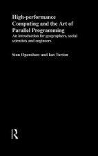
High Performance Computing and the Art of Parallel Programming
347.42 € -

Thermal Infrared Remote Sensing
188.65 € -

Physical Principles of Remote Sensing
183.16 € -

Latest Developments in Geographic Information Systems: Volume I
131.32 € -12 % -
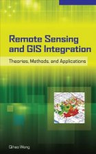
Remote Sensing and GIS Integration: Theories, Methods, and Applications
190.98 € -
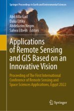
Applications of Remote Sensing and GIS Based on an Innovative Vision
214.36 € -
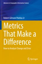
Metrics That Make a Difference
142.19 € -2 % -

Spatial Statistics and Geostatistics
76.12 € -

Mapping with ArcGIS Pro
48.78 € -1 %
Osobní odběr Bratislava a 2642 dalších
Copyright ©2008-24 najlacnejsie-knihy.sk Wszelkie prawa zastrzeżonePrywatnieCookies


 Vrácení do měsíce
 Zdarma od 49.99 €
 02/210 210 99 (8-15.30h)