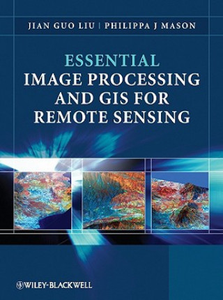
Kód: 04083204
Essential Image Processing and GIS for Remote Sensing
Autor Jian-Guo Liu
Essential Image Processing and GIS for Remote Sensing is an accessible overview of the subject and successfully draws together these three key areas in a balanced and comprehensive manner. The book provides an overview of essentia ... celý popis
- Jazyk:
 Angličtina
 - Väzba: Brožovaná
- Počet strán: 460
Nakladateľ: John Wiley & Sons Inc, 2009
- Viac informácií o knihe

Mohlo by sa vám tiež páčiť
-

Mr. Penumbra's 24-Hour Bookstore
14.62 € -18 % -

Reise zu Auffindung eines Überlandweges von China nach Indien
42.77 € -9 % -

Lehren in Balance
9.88 € -5 % -

Greville Memoirs
64.06 € -

Whales and Dolphins: Colouring Book
5.64 € -22 % -
![Sprache und Literatur (Allgemeines zur Literatur des 2. Jahrhunderts und einzelne Autoren der trajanischen und fruhhadrianischen Zeit [Forts.]) Sprache und Literatur (Allgemeines zur Literatur des 2. Jahrhunderts und einzelne Autoren der trajanischen und fruhhadrianischen Zeit [Forts.])](https://media.libris.to/jacket/02919470t.jpg)
Sprache und Literatur (Allgemeines zur Literatur des 2. Jahrhunderts und einzelne Autoren der trajanischen und fruhhadrianischen Zeit [Forts.])
772.16 € -

Die Deutschen
64.87 € -7 %
Darčekový poukaz: Radosť zaručená
- Darujte poukaz v ľubovoľnej hodnote, a my sa postaráme o zvyšok.
- Poukaz sa vzťahuje na všetky produkty v našej ponuke.
- Elektronický poukaz si vytlačíte z e-mailu a môžete ho ihneď darovať.
- Platnosť poukazu je 12 mesiacov od dátumu vystavenia.
Viac informácií o knihe Essential Image Processing and GIS for Remote Sensing
Nákupom získate 241 bodov
 Anotácia knihy
Essential Image Processing and GIS for Remote Sensing is an accessible overview of the subject and successfully draws together these three key areas in a balanced and comprehensive manner. The book provides an overview of essential techniques and a selection of key case studies in a variety of application areas.§§Key concepts and ideas are introduced in a clear and logical manner and described through the provision of numerous relevant conceptual illustrations. Mathematical detail is kept to a minimum and only referred to where necessary for ease of understanding. Such concepts are explained through common sense terms rather than in rigorous mathematical detail when explaining image processing and GIS techniques, to enable students to grasp the essentials of a notoriously challenging subject area.§§The book is clearly divided into three parts, with the first part introducing essential image processing techniques for remote sensing. The second part looks at GIS and begins with an overview of the concepts, structures and mechanisms by which GIS operates. Finally the third part introduces Remote Sensing Applications. Throughout the book the relationships between GIS, Image Processing and Remote Sensing are clearly identified to ensure that students are able to apply the various techniques that have been covered appropriately. The latter chapters use numerous relevant case studies to illustrate various remote sensing, image processing and GIS applications in practice.§§A CD-ROM accompanies the text and includes essential application samples and datasets using the techniques/algorithms referred to in the book.
 Parametre knihy
Zaradenie knihy Knihy po anglicky Earth sciences, geography, environment, planning Geography Geographical information systems (GIS) & remote sensing
96.14 €
- Celý názov: Essential Image Processing and GIS for Remote Sensing
- Autor: Jian-Guo Liu
- Jazyk:
 Angličtina
 - Väzba: Brožovaná
- Počet strán: 460
- EAN: 9780470510315
- ISBN: 0470510315
- ID: 04083204
- Nakladateľ: John Wiley & Sons Inc
- Hmotnosť: 898 g
- Rozmery: 247 × 189 × 23 mm
- Dátum vydania: 24. July 2009
Obľúbené z iného súdka
-

Cartography.
64.97 € -6 % -

Semiology of Graphics
123.49 € -4 % -
Mastering Geospatial Analysis with Python
56.90 € -

Learning ArcGIS Pro
56.90 € -
Designing Better Maps
70.21 € -2 % -
Geographic Information Science and Systems 4e
226.30 € -7 % -
GIS for Science
44.99 € -7 % -
LiDAR Remote Sensing and Applications
128.63 € -
Geocaching
16.94 € -19 % -

Introduction to Geographical Information Systems, An
85.35 € -

Connections and Content
47.11 € -4 % -

Springer Handbook of Geographic Information
388.44 € -
Focus on Geodatabases in ArcGIS Pro
66.78 € -6 % -
Esri Guide to GIS Analysis, Volume 3
50.44 € -7 % -
Geoinformatics
33.49 € -1 % -
Framework for Geodesign
91.60 € -3 % -
Mastering ArcGIS Server Development with JavaScript
50.84 € -

Reconstruction and Analysis of 3D Scenes
184.33 € -2 % -
GIS For Dummies
29.86 € -18 % -
ArcGIS Book
23.10 € -7 % -
Python For ArcGIS
131.96 € -

Spring Boot Messaging
50.54 € -
GNSS - Global Navigation Satellite Systems
218.84 € -
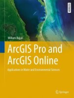
ArcGIS Pro and ArcGIS Online Applications in Water and Environmental Sciences
89.99 € -

Sustainable Development and Geospatial Technology
223.17 € -
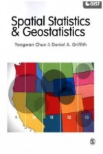
Spatial Statistics and Geostatistics
62.55 € -

Introduction to Remote Sensing
141.75 € -

GIS in Land and Property Management
288.96 € -

QGIS Python Programming Cookbook -
56.90 € -
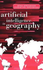
Artificial Intelligence in Geography
332.85 € -

GIS and Spatial Analysis for the Social Sciences
124.30 € -
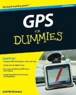
GPS For Dummies 2e
22.59 € -18 % -

Energy of Nations
51.35 € -
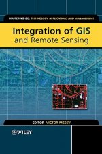
Integration of GIS and Remote Sensing
250.32 € -
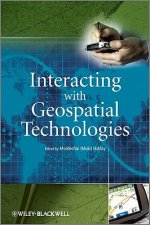
Interacting with Geospatial Technologies
150.53 € -
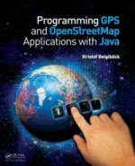
Programming GPS and OpenStreetMap Applications with Java
87.87 € -
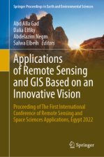
Applications of Remote Sensing and GIS Based on an Innovative Vision
222.67 € -

Learning QGIS 2.0
28.75 € -
Introduction to GIS Programming and Fundamentals with Python and ArcGIS (R)
134.49 € -
Satellite Interferometry Data Interpretation and Exploitation
169.30 € -4 % -
Mastering QGIS -
62.85 € -
Open Source GIS
186.25 € -
Error Propagation in Environmental Modelling with GIS
156.38 € -
Physical Principles of Remote Sensing
190.58 € -
Thermal Infrared Remote Sensing
196.03 € -

Geospatial Techniques in Urban Planning
186.25 € -
High Performance Computing and the Art of Parallel Programming
388.44 € -

Latest Developments in Geographic Information Systems: Volume I
137.71 € -7 % -
Remote Sensing and GIS Integration: Theories, Methods, and Applications
198.35 €
Osobný odber Bratislava a 2642 dalších
Copyright ©2008-24 najlacnejsie-knihy.sk Všetky práva vyhradenéSúkromieCookies


 21 miliónov titulov
 Vrátenie do mesiaca
 02/210 210 99 (8-15.30h)